Your cart is currently empty!
JORBA powered by Trailforks.com
- Membership Bonuses
- CR/WVP Updates: Ida-Over, High Tech Support, & Yellow TweaksImprovements on blue, white, and yellow have been creeping in over the past few weeks. Read the full article to see what’s been going on at The Rock, the start of Monday rides, and to sign up for future CR-specific TM days.
- New Bridgewater Twp. Park Optimized for MTBBridgewater’s new park to be developed with pro trail builders, JORBA providing ongoing maintenance.
- Middlebrook Trail Boardwalk Repair – COMPLETEDProcess and Progress
- Somerset County Volunteer Park Patrol ScheduleSomerset County Parks is running it’s volunteer park patrol at Sourlands and Washington Valley.
Links
- Trail Conditions
- MTBNJ Community Discussion
- Washington Valley Park – Google Maps
- Somerset County Park Commission – Park Website
Description
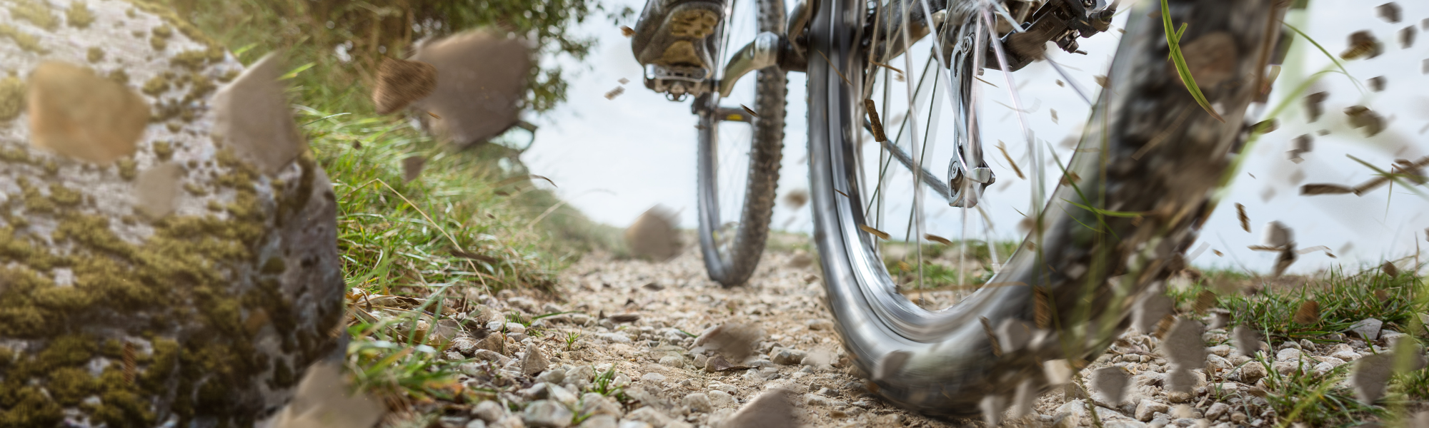
Washington Valley Park (also known as Chimney Rock) consists of approximately 705 acres and offers recreational opportunities in an undisturbed natural setting, including hiking, mountain biking, and hawk watching. The 14+ miles of trails are some of the best mountain biking trails in the central part of the state.
The operative word at Chimney Rock is “ROCK” – there are lots of them, small ones, large ones, and even some sloping exposed rock faces to ride up. There are also a lot of tree roots, stream crossings, and steep hills. Generally, the trails (with a couple exceptions) are technically and physically demanding. The White Trail, and the Yellow Trail south of Miller Lane, are suitable for beginning MTB riders who are looking for some fun trails with a bit of challenge and don’t mind walking a few stretches.
All trails loop back to their beginning or link up with other trails, and there are many interior and cross trails permitting a multitude of ride variations. Elevation range is from about 200 ft above sea level along the reservoir to about 400 ft at Miller Lane; some of the climbs are grueling and include stretches with very loose rocks and gravel.
Riding Washington Valley/Chimney Rock is great fun, it has lots of varied terrain, and many lovely views. A squishie is recommended but not necessary. Remember to keep your head up, brain engaged, and know your abilities – over the bar (OTB) experiences are definitely not unknown.
Additional Information
Washington Valley Park is located about ½ mile south of Martinsville, NJ, and about 1 mile north of US Route 22. Access can be via Newmans Lane, Chimney Rock Road, or Vosseller Avenue to Miller Lane. There are parking facilities directly in the Park off Newmans Lane and Miller Lane. Access from Chimney Rock Road is via a township park with baseball/soccer fields on the east side of the road – park your car and either head north about 200 yards on Chimney Rock Road to an inconspicuous trail head on the west side of the road, or follow the disc golf course (east of playing fields) to the far south-east corner of the meadow and head down the pitch, across a couple creeks, and you will pick up the Yellow or Orange Trail (both major climbs).
Trails
- Red – This trail goes up and down the hill on the south side of the reservoir, with no flat stretches to speak of. It is rocky virtually throughout, the only areas without rocks have a lot of roots, there are some interesting creek crossings, and log hops with alternate routes. None of the slopes are very steep but some of them are quite long and have many obstacles along the way to stop any momentum you might hope to obtain. Try all of the interior and cross (C) trails, they’re lots of fun, with a surprise around every turn, just like the perimeter trails. The trails and forks may seem a bit confusing at first but it is difficult to get terribly lost, keep riding and something will look familiar. The Logan Road (fire access, the only dual track) is not officially a trail on the map but makes a good connection over to the White or Orange Trails and though not very steep the lumps make riding up a chore. The upper part is probably about the lumpiest thing you’ll ever ride on.
- Blue – Across Newmans Lane (west) from the parking lot lies the Blue trail. More up and down, twisty singletrack with almost no flat areas; except along the bottom of the hill near the Middle Brook. The Middle Brook though has some drainage problems and an abundance of highly exposed tree roots and is planned for a re-routing soon. Much like the Red Trail the Blue Trail is rocky everywhere, and the only areas without rocks have a lot of roots. A couple creek crossings just add a little frosting to the cake. But these are all natural obstacles, near the high point of the trail, after you’ve run out of air and strength there is a “skinny”. This man made, narrow ramp/bridge was built to test if you can ride straight after the lung bursting climb up the trail. Its great fun to try and ride perfectly straight after zigging, zagging, lunging, dodging along the trail. Many a rider I’ve watched roll by looking the other way, pretending it isn’t there – they’ve had enough challenges without an artificial one in the mix. Most of the slopes on the Blue Trails are reasonable, though there are a couple really steep pitches grafted into the middle of some ascents just to make things difficult. Again, you should try all the interior and cross trails, they’re just as fun as the perimeter trails. You will find some fairly long downhill stretches here and there to reward your effort getting to the top.
- White – This trail occupies land north of the reservoir. It is the easiest trail technically, but it is not at all like your public park bicycle path. It is twisty, flowy, fun, fast singletrack, somewhat up and down with several steep pitches, has fewer rocks than the rest of the Park, a couple creek crossings, and quite a few roots. There is also an area at the north end that is fairly swampy that you may want to avoid if it has rained recently, or has generally been damp. Use the cross trail to avoid the low lands.
- Orange – This trail is sort of sandwiched between Chimney Rock Road and Gilbride and is best accessed via Logan Road from the Red Trail, or from the Township Park on Chimney Rock Road. Differing from the previous trials, this one is simply hard up or hard down singletrack, about 2/3 rocks (some very loose), and the rest roots. Slope gradient varies from moderate to brutal to boarder line insane, while being constantly up for an interminable period. One pitch descending from near Gilbride to the East Branch Reservoir is difficult to even walk down; riding is a locked brake affair trying to keep your bike under control. I’ve not seen anyone ride up it. This area is great for those trying to get into racing condition.
- Yellow – The Yellow Trail represents the extremes of Washington Valley/Chimney Rock, containing both the most difficult and the easiest trails. The easy trails are just south of Miller Lane, they are flat and a mixture of fun twisty stuff or quite straight with a few rocks. Though as you start heading further south from the road the trails get more difficult with some pretty severe slopes, and rocks and roots to contend with. North of Miller Lane is another story. The upper part is pretty much like the rest of Washington Valley, lots of rocks, quite a few roots, and either up or down for some fairly long stretches. The lower part is just plain gnarly, comprised of loose rock and gravel on steep to very steep terrain, or a chaotic jumble of baseball to football sized rocks on fairly steep terrain. By the map it appears that the steep stuff can be avoided by utilizing the trail that travels just east of the Reservoir, this is misleading because that trail section is beset by treefall and a variety of obstacles making for a lot of hike-a-bike, or advanced Trials maneuvering a-la Ryan Leech. It’s all good fun, but be prepared for a bit of hike-a-bike heading up from the reservoir, unless your skill level is fairly high.