Your cart is currently empty!
Stags
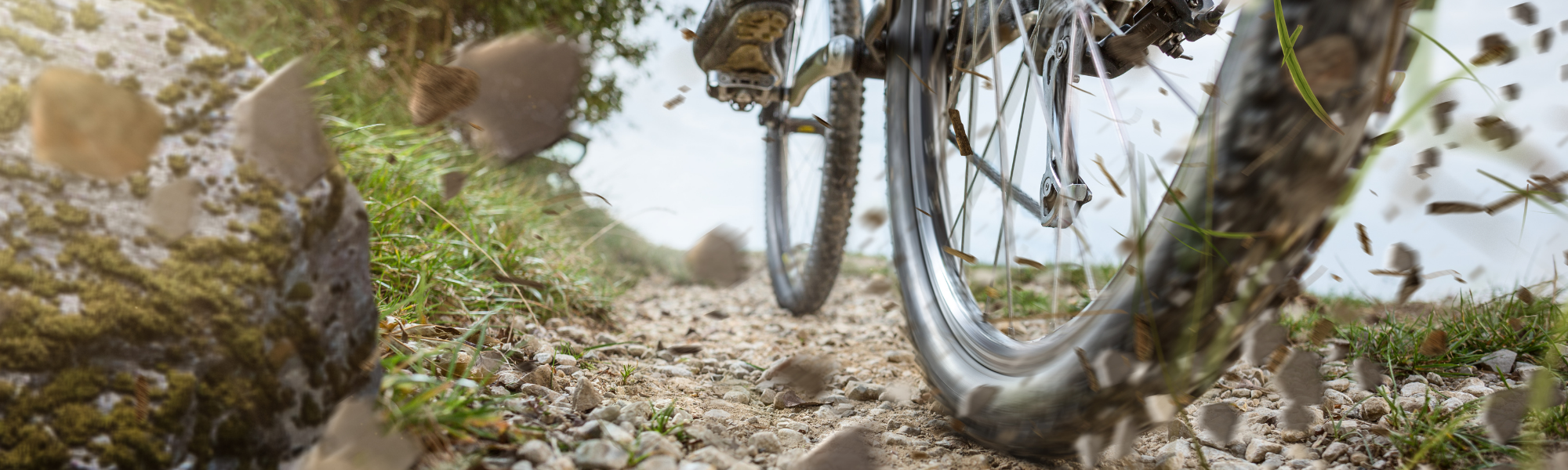
New Jersey’s first accessible trail for adaptive riders
Stags is the next section of the Tapawingo project. A joint project of the NY-NJ Trail Conference and JORBA to upgrade and connect the trail network Long Pond Ironworks State Park and Norvin Green State Forest. Originally conceived as a reroute around an unsustainable section of the legacy Hewitt-Butler trail. Stags would connect the Tanks and Cages trails in Jungle Habitat to the Tapawingo route.
Seeing as Stags would require a new section of trail to be built, with consideration of the concerns of our hiking partners we endeavored to reduce the number of turns to avoid building separate lines for hiking and mountain biking. By reducing the number of turns, with just a little more work we could make the trail suitable for adaptive riders.

Stags
To accommodate adaptive riders, from the corner outside fence line, Stags will be as straight as possible with a 7% overall grade, 4′-6′ wide to the existing trail.
The Top Quad Trail
Will be updated to make it sustainable and rerouted to meet adaptive trail standards.

But just having one small section of trail suitable for adaptive riders is not enough. Getting the adaptive rider to the trail is just as important. The route will incorporate sections of the Top Quad trail and access from the secondary access road Safari 1. The width is right, the tread will need to be reworked. To discourage ATV use, special attention will need to be made for signage onto Stags. At the north ends Stags will connect to an existing woods road, and only minor work will be necessary to get the adaptive rider back for another lap.
With the successful launch of Stags as NJ’s first adaptive trail, we can stack small loops of adaptive trails into Tiger Pen and around Boon. Adding to the networks trails suitable for more adaptive riders.
Stags construction is complete.
Latest Stags Posts
- Access Nature Forum – Through discussion making the outdoors more inclusive

- Northwest New Jersey Rivers Conference Adaptive Mountain Bike Presentation
- Save the Trail, Ban the Blower
- JORBA in the News
- Stags Adaptive MTB Ribbon Cutting
- Stags Stage 1 is Complete
- JORBA Receives Two for the Trails Grant From Athletic Brewing
- Progress on Stags Tapawingo in Jungle
- JORBA is a Santa Cruz PayDirt Recipient
- JORBA Awarded Fox Factory Trail Trust Grant
- Stags aMTB Trail
Specifications
The trail will be built from native material to USFS Class 4 standards. The final trail will be 48″-72″ in width. No obstacles over 5″. Maximum grade grade <15%, overall grade 7%. Maximum out slope <5%. Difficulty will be suitable for beginner to intermediate adaptive riders and beginner MTB riders.
Stags aMTB Route
When complete Stags will be a 3950′ route suitable for beginner to intermediate adaptive riders, mountain bikers and hikers.
New Reroute
Approximately 1184′ of new trail will be build to reroute around unsustainable section of legacy trail. This reroute will be as straight as possible to accommodate hikers as well as adaptive mountain bikers. It will be 4′-6′ wide with a flat and stable surface with an overall grade of 7%. No obstacles over 5″ and maximum grade cannot exceed 15%.
Avoid Bedrock Pinches
To avoid bedrock pinches 633′ aMTB trail will connect to the existing woods road.
Existing Roads
Approximately 2293′ of existing woods road will be reworked to accessible standards
Resources
Mobilization
Mobilization through the gate up Airport Road, Safari 1 to Top Quad to worksite. View Map Here.
Potential Equipment
BFP602 Walk-behind Rubber Track Carrier. Length x Width x Height (in.) 77 x 31 x 41
- Horsepower 24.8 hp
- Operating Weight 6,489 lb
- Bucket Digging Force 5,652 lbf
- Maximum Reach at Ground Level 16 ft
- Width 61 in
- Tail Swing Type Minimal
Hitachi ZX17U-5 Compact Excavator
- Net Power 11 kW 15 hp
- Operating Weight 1720 kg 3,790 lb.
- Max Dig Reach 3.81 m 12 ft. 6 in.
- Max Dig Depth 2.19 m 7 ft. 2 in.
Bobcat T76 Compact Track Loader
- Rated Operating Capacity (ISO) 2,900 lb
- Operating Weight 10250 lb
- Ground Pressure (Rubber) 6.2 psi
- Auxiliary Std Flow 23.3 gal/min
- Auxiliary High Flow 30.3 gal/min
Tapawingo Stags Project Admin
Overview
Stags is the next section of the Tapawingo project, which is a joint project of the NY-NJ Trail Conference and JORBA to upgrade and connect the trail networks at Long Pond Ironworks State Park and Norvin Green State Forest. Originally conceived as a reroute around an unsustainable section of the legacy Hewitt-Butler trail, Stags was designed to reduce the number of turns to avoid building separate trails for hiking and mountain biking. By reducing the number of turns and redefining the trail specifications, Stags could be suitable for adaptive riders. Existing woods roads will then be upgraded to sustainable accessible standards. When completed, Stags will be a 3950′ route suitable for beginner to intermediate adaptive riders, mountain bikers and hikers.
Scope of Work
The scope of work includes constructing a new section of adaptive mountain bike trail in two phases as well as renovation of existing woods roads to bring them up to aMTB standards. The new trail construction, (Phase 1 being the Stags, Hewitt Butler Reroute 1,184’, Phase 2 being the North Hole Reroute 633 ‘) will conform to aMTB GREEN standards as well as USFS Trail Classes 3/4 (developed/highly developed) standards. The new construction would have an average width of 72” and a minimum width of 60” with a target grade of 7% and a short pitch maximum grade of 15%. The trail cross slope is to be between 3% and 7% or the maximum
necessary for drainage. The minimum turn radius will be 20’. The trail surface will be native material, utilizing onsite borrowing and minimal imported material where required. Some deviation from aMTB Green standards may be required given the type of terrain in the area. Phase 3, the reconstruction of 2,437’ of existing woods roads, is to conform to the same standards as phases 1 and 2 with some deviations possible based on the existing routes of the woods roads.
Three stages, details below. 1. The original reroute. 2. The aMTB reroute connecting to the upper woods road. 3. Reworking existing woods roads as necessary. Am I missing anything?
Stage 1
Approved
Stags, Hewitt Butler Reroute, as straight as possible with 7% Grade to existing trail 1184’ USFS Class 3-4 aMTB Easy,

Bids due Apr 15, 2022 Completed
Bids Evaluated Apr 17, 2022 Completed
Bids Awarded Apr 19, 2022 King Trail Alliance. Completed
Stage 1 Approval Apr 27, 2022 Approved
PO May 2, 2022 Completed
Site Meeting Planning Flagging Tom Hennigan May 5, 2022 Completed
Works Starts Stage 1 May 1, 2022 Not Started
Stage 2
Approved
Stags, aMTB North Hole Reroute 633’ built to USFS Class 3-4 aMTB Green. This will connect to the upper woods road.

Stags Adaptive MTB Project Request for LMR Stage 2 Apr 1, 2022 Approved
Stage 2 Land Management Review Jul 1, 2022 Approved
Stage 2 Work commences Aug 1, 2022 Not Started
May 5, 2022
- Mountain bike trails should avoid all streams, seeps, wetlands and wetland buffers, and vernal pools to protect habitat for odonates, amphibians, and other species.
- If any trees will be felled:
- Bats: The area is documented as habitat for the federal threatened Northern myotis (a.k.a. Northern long-eared bat) and as potential habitat for the federal endangered Indiana bat. Both species are “bark-roosting” bats that may roost within trees or shrubs with sloughing bark and/or bark with cavities/cracks/crevices. IF trees or shrubs >3” DBH will be cut and can not be excluded from the project, AVOID cutting during the bats’ active season (April 1 through September 30). This timing restriction represents the standard guidance the USFWS would provide via consultation for Indiana bats. The ENSP strongly recommends this timing restriction be incorporated into the project-wide scheduling and/or that you “consult” with the USFWS field office if the timing restrictions pose a problem to the project. If P&F need to discuss the bat timing restriction, they should contact Rebecca Klee, USFWS (908-930-1878; Rebecca_Klee@fws.gov).
- Woodland Raptors – Given the proximity of barred owl observations to the property boundaries and what appears to be potential suitable habitat on site, it is possible that barred owls and/or red-shouldered hawks or northern goshawks may be nesting on the property. Surveys should be conducted for presence/absence and for nest/cavity trees before any tree removal begins to minimize disturbance/harm to nesting birds.
- This general area is inhabited by multiple species of reptiles (and amphibians). As such, it is imperative that IF a new trail (or segment of trail) will be created, the existing trail that will be replaced by this project must be successfully eliminated. P&F can determine the best approaches to achieve this (e.g., tree felling to block trail segment ends AND within the segment, steps to encourage vegetation regeneration, signage, etc.). Please note, tree felling will require timing restrictions to minimize harm to bats and nesting birds (no tree felling April 1 – October 31). · Do not place felled logs or debris piles adjacent to the new trail as these create suitable hunting areas for copperheads that may inhabit the area. · If the existing trail cannot be successfully eliminated, the ENSP will need to revisit this proposal.
Stage 3
Approved
2437’ of additional work on existing woods roads would be necessary to make the route suitable for adaptive riders.

Work Starts Stage 3 Immediately after of concurrent with stage 1 Not Started
The Finished Product
The finished aMTB route will consist of 1817’ of new trail (red) and 2437’ feet of reworked woods roads.
Grand Opening Oct 1, 2022 Completed
Hewitt-Butler Legacy Trail Closure. Oct 31, 2022